"...Mawar will approach the Sakishima Islands off the main island of Okinawa..."
On Monday, the Japan Meteorological Agency (JMA) have issued advisories highlighting the likelihood of hazardous conditions including rough seas, high tides, violent winds and torrential rain due to the approach of Typhoon Mawar to the southernmost prefecture of Okinawa.
Related:
The Japan Meteorological Agency (JMA) said Typhoon Mawar is set to approach the southwestern part of Okinawa if it continues along its current trajectory as of 9 a.m. local time on Monday, which was in a northward direction from the east of the Philippines, at a speed of around 10 km per hour.
The speed of the typhoon's winds has augmented from 162 km per hour (kph) in proximity to its epicenter, as recorded on Sunday evening, to prevailing speeds reaching 216 kph, while the atmospheric pressure at the center of the typhoon measures 950 hectopascals.
According to the JMA, Mawar will approach the Sakishima Islands off the main island of Okinawa. The JMA has issued a warning regarding the typhoon's slow movement, which implies that its severe weather conditions could persist for an extended duration. Moreover, the typhoon's high-pressure system may trigger atmospheric fluctuations throughout extensive areas of Japan.
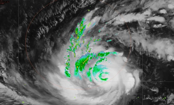
#02W #Invest97W #Cyclone #Hurricane #typhoon #Guam #97W #Japan #Mawar #Taiwan #Philippines #BettyPH #MawarPH #SuperTyphoonMawar #TyphoonMawar #SuperTyphoonBetty #BagyongBetty #TyphoonBettyMawar
— StormWatch (@StormWatch12345) May 28, 2023
The latest track of Typhoon Mawar
Taiwan. Monday, 29 May 2023
7:22 am CST (UTC+8) pic.twitter.com/d5rcHeLH8C
As per the agency's report, on Monday, the maximum wave height could potentially reach five meters on the principal island of Okinawa, whereas it may escalate up to seven meters near the Sakishima Islands.
The JMA has also said that an extended front has been forecasted to produce substantial rainfall in both eastern and western regions of Japan in the upcoming days.
The agency has issued a caution for residents in low-lying regions to maintain a state of alert with regard to potential impacts from landslides and flooding.
The report also explained that an elevation in river levels might result in the potential breach of their banks, in conjunction with a possibility of lightning strikes.