







Colombia’s Natural Disasters History Reveals Persistent Class-Biased Risks
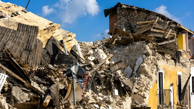
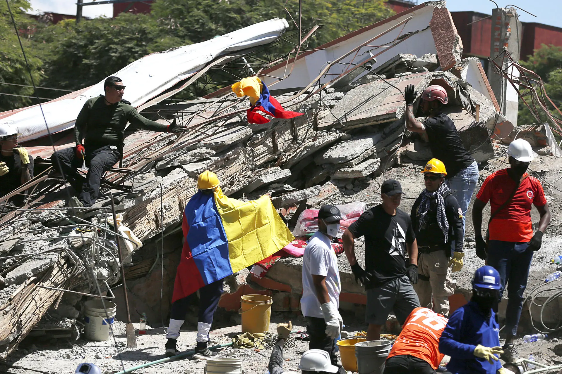
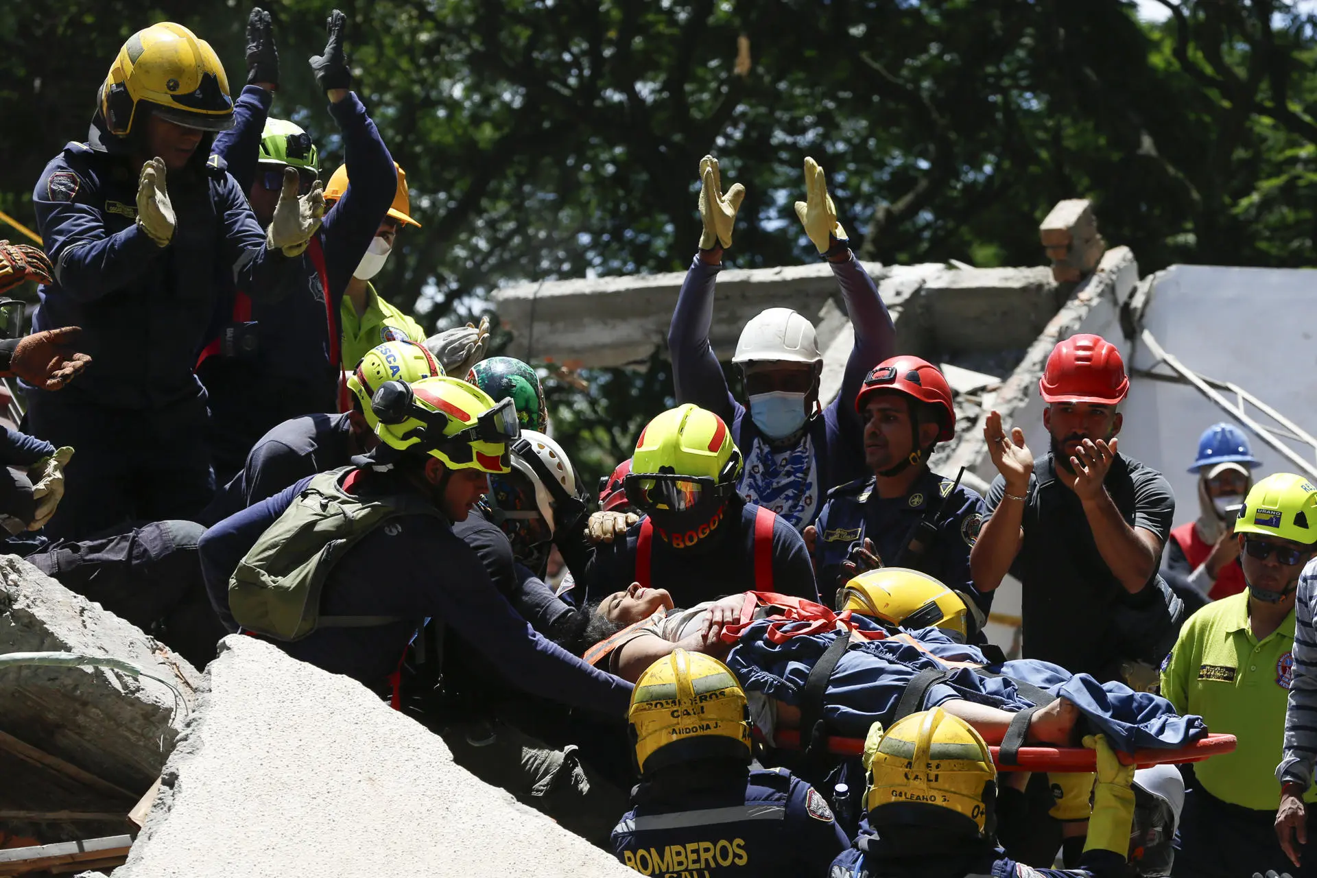
Choco Earthquake 2026. Photo: Metropolitano
August 11, 2026 Hour: 2:46 pm
🔗 Comparte este artículo
Social disparities and state abandonment dictate who survives earthquakes, volcanic lahars, and widespread flooding.
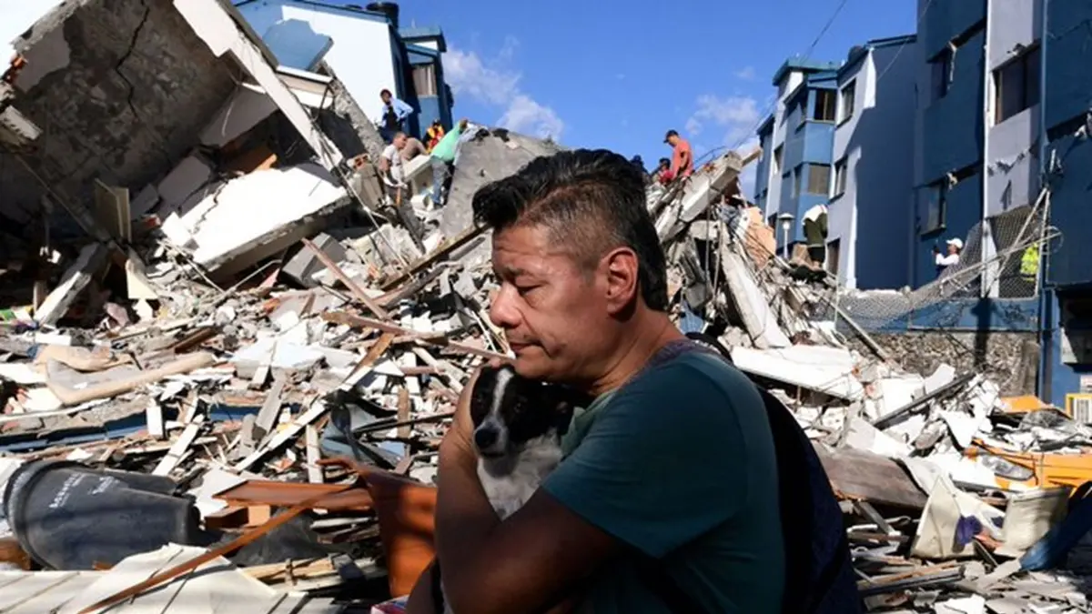
The recent 7.4 magnitude earthquake that struck Colombia on August 10, centered in the department of Chocó, serves as a stark reminder of the profound vulnerability to natural hazards.
RELATED:
Colombian Presidency Counts 181 Deaths From Earthquake
While the immediate cause of such events is geological, their ultimate human impact is largely determined by socio-economic factors. Decades of internal armed conflict, forced displacement, informal urban settlement, and institutional neglect have historically pushed vulnerable communities onto precarious, high-risk terrains.
Physical hazards repeatedly transform into humanitarian crises due to delayed state warnings, weak enforcement of building regulations, environmental degradation, and historical gaps in regional prevention funding.
The Political Economy of Risk in Modern Colombia
Colombia is in a geographical location that experiences frequent geological and meteorological activity because it lies at the intersection of the Nazca, South American, and Caribbean tectonic plates.
In addition, Colombia’s mountainous topography, positioned along the Intertropical Convergence Zone, exposes its regions to extreme weather patterns, which are regularly amplified by the El Niño and La Niña phenomena.
In Colombia, land inequality and decades of internal armed conflict have forced millions of displaced rural citizens into urban centers. Many of these displaced families settled in informal neighborhoods built on unstable hillsides, riverbanks, and natural floodplains.
A review of historical data from state agencies and independent investigative archives shows a consistent pattern in how disasters unfold. Physical hazards often culminate in human catastrophes due to delays in public warnings, weak enforcement of building codes, and historical gaps in regional disaster-prevention funding.
The 1985 Armero Tragedy
On November 13, 1985, Colombia experienced the deadliest natural disaster in its recorded history. The Nevado del Ruiz volcano, located in the Central Cordillera of the Andes, erupted, generating pyroclastic flows that melted roughly 9 percent of the volcano’s glacial ice cap. This rapid melting released millions of cubic meters of water, which mixed with ash, mud, and rocks to form massive volcanic mudflows known as lahars.
The lahars traveled down the river valleys surrounding the volcano at speeds of up to 50 kilometers per hour. A major lahar reached the town of Armero in the Tolima department, located about 48 kilometers from the volcano. The mudflow swept through the municipality, destroying structures and burying the town. Out of Armero’s estimated population of 29,000 residents, more than 23,000 people died.
On the afternoon of November 13, ash fell on Armero, but civic and political leaders instructed residents to stay indoors and, with no municipal evacuation order issued, most people were in their homes when the mudflow struck the town late that evening.
In response to these institutional failures, the government enacted Law 46 of 1988 and Decree 919 of 1989, which created and organized the National System for Disaster Prevention and Attention.
The 1999 Coffee Region Earthquake
On January 25, 1999, a surface-level earthquake with a magnitude of 6.2 struck Colombia’s primary coffee-growing region, known as the Coffee Region. The epicenter was located in the department of Quindío. Because the focal depth was extremely shallow, measured at less than 10 kilometers, the seismic waves released immense kinetic energy directly into urban centers that were unequipped for high-intensity shaking.
The quake caused severe destruction across five departments. Armenia suffered the most catastrophic damage, with nearly 60 percent of its building stock damaged or destroyed. Official reports confirmed that 1,185 people died, more than 4,000 sustained severe injuries, and over 200,000 residents were left homeless.
The economic damage was estimated at approximately 1.8 billion U.S. dollars, which represented roughly 2.2 percent of Colombia’s gross domestic product at the time, crippling the regional agricultural and commercial sectors.
The spatial distribution of mortality and structural failure revealed stark class disparities. The highest casualty rates occurred in low-income neighborhoods and informal settlements along Armenia’s urban peripheries. These areas were heavily populated by vulnerable families, including thousands of internally displaced persons fleeing the escalating internal armed conflict in rural regions.
The 2010–2011 “Winter Wave”
Between mid-2010 and early 2011, Colombia experienced the most extensive meteorological emergency widely known as the Ola Invernal or Winter Wave. The crisis was triggered by an unusually intense La Niña phenomenon.
The volume of precipitation overwhelmed the country’s major hydrological basins, including the Magdalena, Cauca, and San Jorge rivers, leading to sustained nationwide flooding and widespread slope failures.
The flooding impacted 28 of Colombia’s 32 departments and more than 1,000 municipalities, directly affecting over 3.2 million people, roughly seven percent of the national population. The official government census recorded over 500 deaths, hundreds missing, and the destruction or severe damage of more than 400,000 homes.
Furthermore, over one million hectares of prime agricultural land were submerged, killing hundreds of thousands of livestock and destroying essential food crops. Economic assessments by the National Planning Department estimated the total material losses at over 5.2 billion U.S. dollars.
Although extreme weather was the immediate meteorological trigger, the extraordinary severity of the flooding was heavily driven by decades of environmental degradation and agro-industrial expansion along Colombia’s main river systems.
In addition to agricultural expansion, widespread deforestation along the upper and middle basins of the Magdalena and Cauca rivers severely degraded soil stability. Without natural forest cover, topsoil was washed directly into river channels, causing heavy silt accumulation that raised riverbeds and drastically reduced their water-holding capacity.
The 2010–2011 emergency demonstrated that when natural water systems are altered for private economic extraction, extreme weather events do not remain localized environmental issues; they transform into systemic socio-economic crises that devastate vulnerable rural populations.
The 2017 Mocoa Debris Flow and the 2026 Chocó Earthquake
On the night of March 31, 2017, a sudden meteorological event caused terrible human and environmental disasters in Colombia. Over three hours, torrential rainfall battered the upper basin of the Mocoa River in the southwestern department of Putumayo.
Rain gauges recorded an amount in a single night, representing more than 30 percent of the region’s average total monthly rainfall. The surge created a debris flow, a dense wall of water, mud, and rocks, that swept through Mocoa around midnight, killing at least 333 people, injuring over 400, and displacing more than 22,000 residents.
Decades of unmanaged deforestation along the surrounding mountain slopes had severely weakened the natural forest ecosystem. Broad clearance of native vegetation for extensive cattle ranching, illegal timber logging, and subsistence farming stripped the soil of the deep root networks that naturally bind topsoil.
Lacking resources and access to affordable housing, thousands of families displaced by Colombia’s internal conflict had built informal settlements directly along known high-risk riverbanks and active geological floodplains.
In the same way, The vulnerability of peripheral regions to seismic hazards was underscored on August 10, 2026, when a major 7.4 magnitude earthquake struck western Colombia.
The epicenter was located near San José del Palmar in the department of Chocó, at a depth of 110 kilometers. The earthquake was felt across 32 departmental capitals, causing shaking in major urban centers including Pereira, Manizales, Cali, Medellín, and Bogotá.
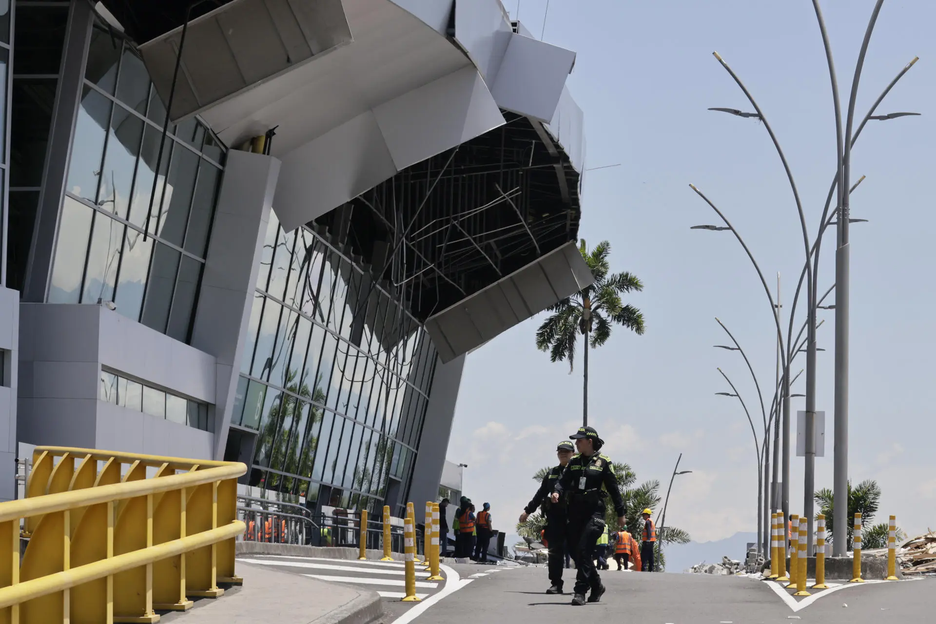
Preliminary assessments have confirmed over 200 fatalities, more than 1,300 injuries, and significant destruction to residential structures, transport routes, and regional airports.
The severe impact in cities like Pereira and Manizales highlighted persistent vulnerabilities in older masonry buildings and municipal infrastructure. The event is serving as an immediate reminder that seismic risk in western Colombia remains an ongoing threat to peripheral communities and major urban centers alike.
Climate Resilience and Environmental Justice
An examination of Colombia’s major modern natural disasters shows how extreme hazards have been transformed into human and socio-economic catastrophes by intersecting with deep social inequalities, institutional inaction, and unmanaged urban expansion.
Historical evidence indicates that physical events do not affect all citizens equally: when hazards strike, under-resourced populations suffer the highest losses of life and property, a pattern reinforced by structural inequalities and fragile institutions.
At the same time, environmental degradation has drastically reduced the landscape’s natural resilience, as the destruction of wetlands for industrial agriculture, widespread deforestation for cattle ranching, and disruption of water systems have weakened the land’s capacity to absorb heavy rainfall and prevent landslides. Addressing these challenges requires a fundamental shift in public policy in the southern nation.
Sources: TeleSUR – BBC – RTVC – Radio Nacional Colombia – Vorágine – RUMS – Rutas del Conflicto – Volcánicas – El Tiempo – El Espectador
Author: Silvana Solano
Source: teleSUR